Catch Yard Farm, Silverstone
This Consent, achieved after a second Application and a Public Inquiry, provides for 220 homes, open space, allotments and community orchards, grade II listed building, and wetlands and swales for water management, for Barwood Land and Estates.
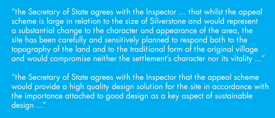
Rummey Design gave key evidence at the Public Inquiry and the Inspector's judgement made it clear that high design standards were instrumental in achieving consent in this Special Landscape Area, opposed by Local Authority and Parish Council. As part of this detailed 'outline' Application, the Inspector required Rummey Design's master plan to become a binding document, and not merely illustrative.
Location
Silverstone, Northamptonshire
Locality
United Kingdom
Project Status
Complete
Client
Barwood Land & Estates Ltd
Site Area
11.00 ha
Project Area
11.00 ha
Industry Sectors
overview
The design was undertaken after thorough work on a the local landscape character, the urban morphology of local villages, and of the evolution of Silverstone specifically. Robert Rummey's Proof of Evidence was able to demonstrate that the scheme could reinstate the 'distinctiveness' in Silverstone that had been lost by successive infill poor development, that the scheme could make a substantial contribution to the quality of the edge of the village, and that the declining landscape quality of the area could be reversed. Post-inquiry it was accepted by the Parish Council that the scheme offered substantial benefits.
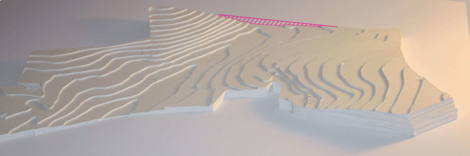
The topography of the valley and the severance caused by the trunk road are clearly shown in this physical model.
Robert Rummey, BArch(hons), DipLA, CMLI, RIBA, FRSA, gave evidence on landscape, urban design and ecology.
Disciplines Involved
urban design strategy
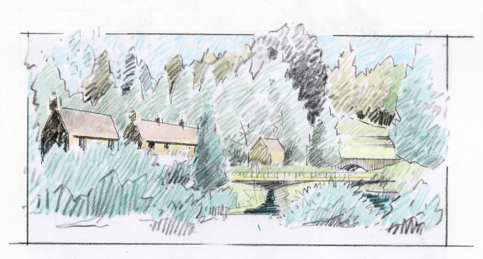
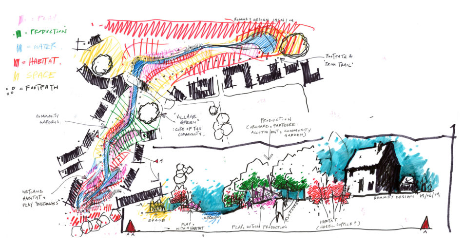
The field pattern, streams and farmhouses, and the value of substantial 'sentinel' trees, were carefully integrated into the scheme to create clear character areas and legibility with the site. Orchards and allotments were integrated with land re-profiling for noise exclusion and adjacent to the boarding dual carriageway. The scheme consisted of a number of 'Ends' - historical accurate groups of dwellings distinctive of Northamptonshire villages. The informal road structure linked these Ends together to create a settlement which is designed to have clarity and distinctiveness.
public inquiry rationale
The Consent was clearly a result of the thought and design process which were inherent in the scheme
- the site was not a Special Landscape Area
- water, landscape and architectural layout were considered in an integrated way
- the scheme provides ways of addressing landscape and flooding concerns, and residents fear of coalescence
- the scheme provides an exemplar for place-making whilst extending an already large village
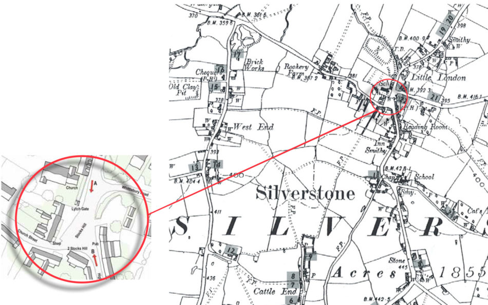
This map from the beginning of the last century clearly shows the distinct 'ends' which in many ways operated as separate but interconnected entities.